

Britain began to warm up after the first stage of glaciation, between 130,000 and 125,000 years ago, and rising seas caused by the melting of the ice sheets carved wave-cut platforms in coastal bedrocks, and deposited new beaches. In Britain this time is known as the Ipswichian Interglacial period – in geological terms a relatively recent phase of the Pleistocene xx. Subsequently, following various geological stages of ice formation and recession, sea levels dropped again to current day levels – leaving these earlier beaches up to 6 metres above present Chart Datum.
Remnants of these raised beaches have been described from around the coastline of the Gower Peninsula in South Wales. Most of the readily available academic texts refer to the sites at Foxhole, Langland, and at Fall Bay. Despite the focus on a few locations which demonstrate the phenomenon particularly well, there would have to be evidence of this sea level change all around the Gower Peninsula – and I discovered for myself an apparently hitherto un-described location for these ancient shell-bearing deposits right on the tip of the Rhossili Headland where it drops down to the Worms Head Causeway.
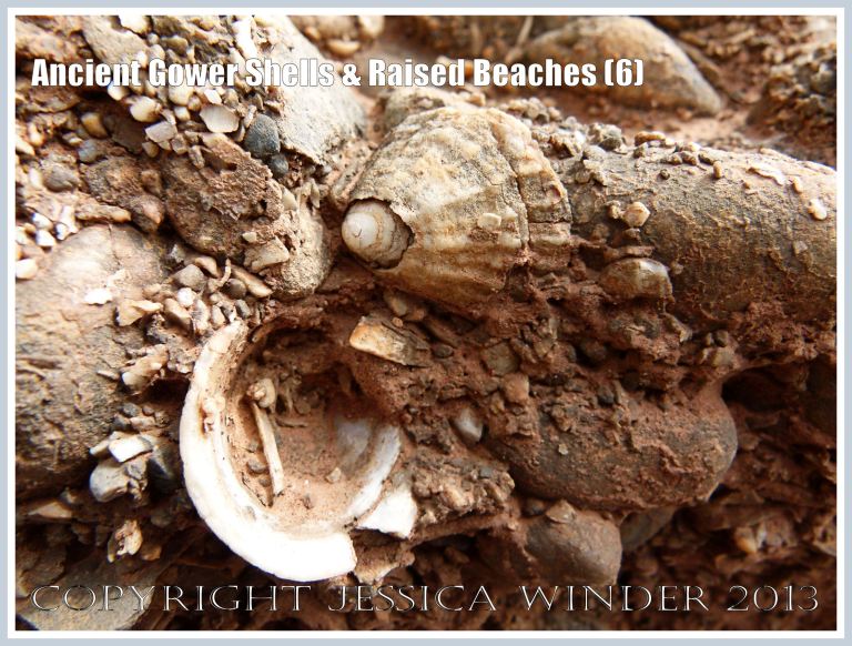
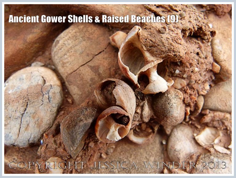
Here I found ancient limpet shells (Patella spp.) and winkle shells (Littorina spp.), embedded with minute shelly fragments and pebbles, in a matrix of reddish, iron-stained sediment consolidated by crystalline calcium carbonate. These deposits were located in cracks and crevices of the jagged limestone bed-rock projecting upwards at steep angles from the shore. More significantly, however, the shells were found in distinct, horizontally-aligned strata clearly visible at the base of the softer recent sediments leading down to the present-day beach.
The layers of ancient beach material originally would have spread out and covered all the bedrock which juts up from the upper and middle shore. It has now been mainly washed away but remains in a few places, almost like a coating of conglomerated cement with hard-core, attached to the Carboniferous limestone outcropping on the higher shore. The horizontal layers of raised beach deposits, seen in vertical section at the base of the headland, are often undercut by extreme high-tide wave action and consequently overhang slightly. Above the raised beach levels are solifluction deposits and red soil.
For more information about the raised beaches of Gower, have a look at:
George, G.T. (2008) The Geology of South Wales – A Field Guide, published by gareth@geoserve.co.uk, ISBN 978-0-9559371-0-1, pp 66-89.
Mullard, Jonathan (2006) Gower, Collins New Naturalist Series, Harper Collins Publishers, London, ISBN-13 978-0-00-716067-6, ISBN-10 0-00-716066-6, pp 44-50.
PS Don’t forget that you can click on individual photographs to enlarge them and read a detailed description of the image.


COPYRIGHT JESSICA WINDER 2013
All Rights Reserved

the breadth and depth of your scholarship is very impressive!
LikeLike
Thank you ….but I am just curious about things and look up the information that explains them in books.
LikeLike
Lovely! Lovely site, lovely pictures and a great commentary. A real pleasure
LikeLiked by 1 person
Thank you, Dave. I really appreciate your comments.
LikeLike